Topography of Niamey
Topographic map of Niamey showing elevation variations and key landscape features.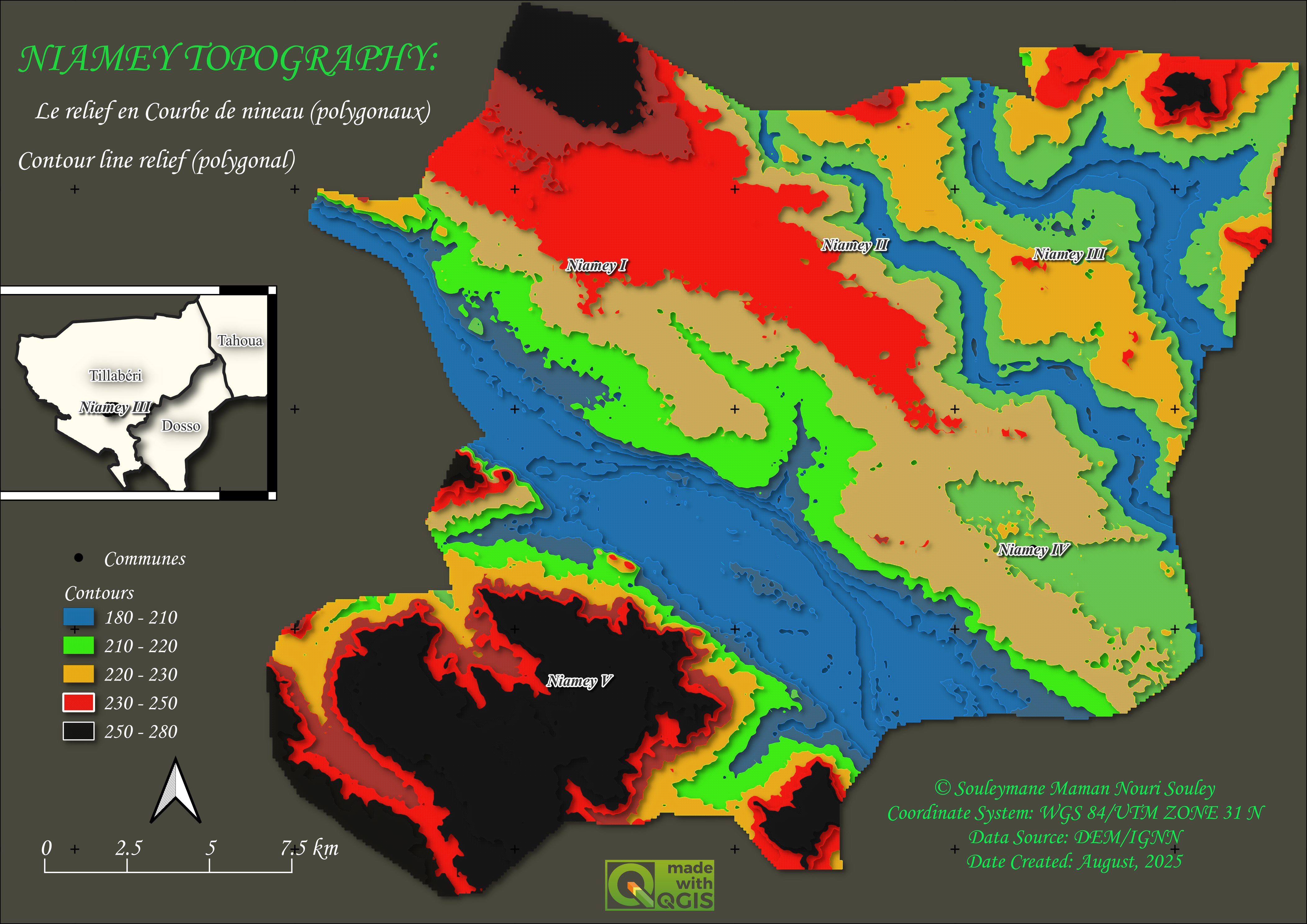

Topographic map of Niamey showing elevation variations and key landscape features.
Map showing the river network hierarchy (levels 1–6) across Niger, created using QGIS with HydroBASINS and HydroRIVERS data.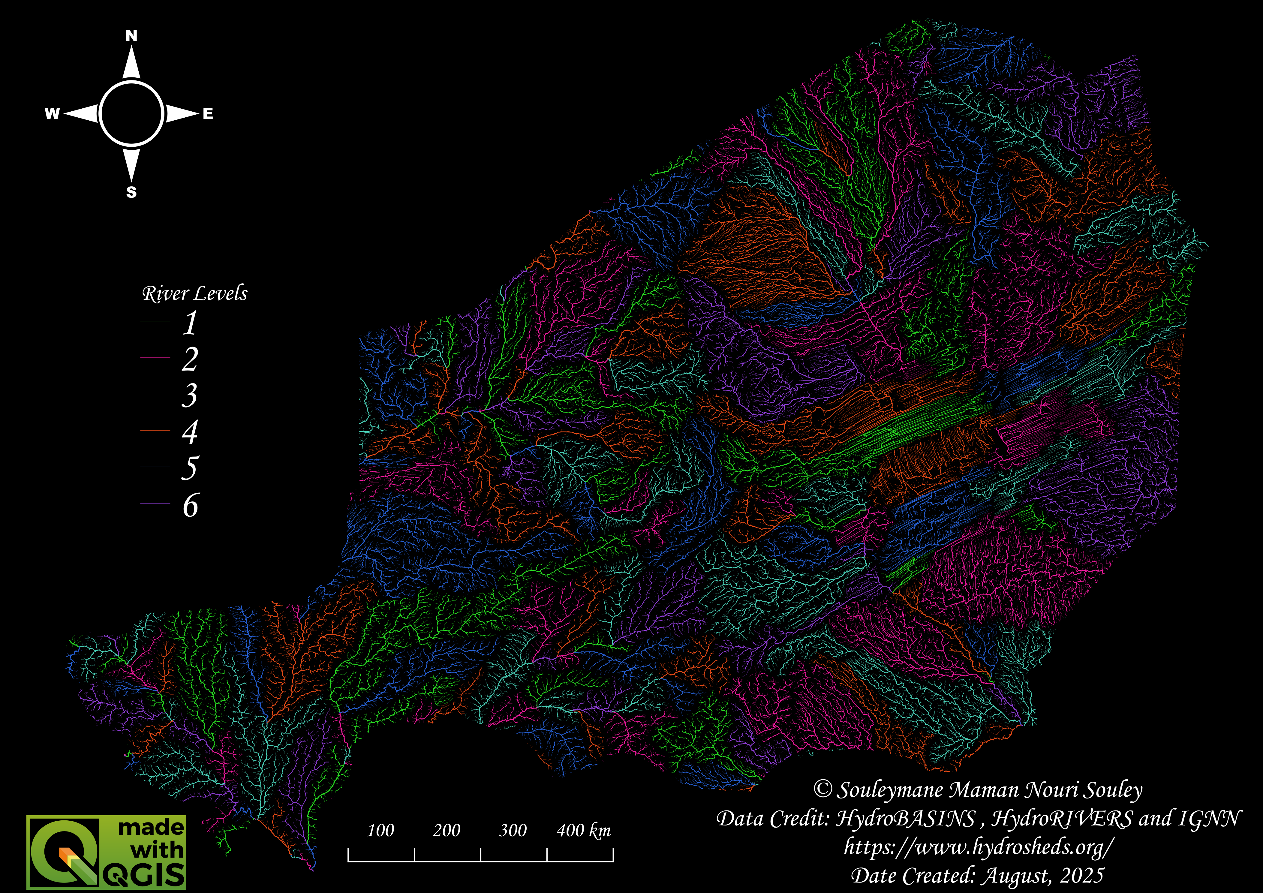
Interactive map visualisation with geographic data
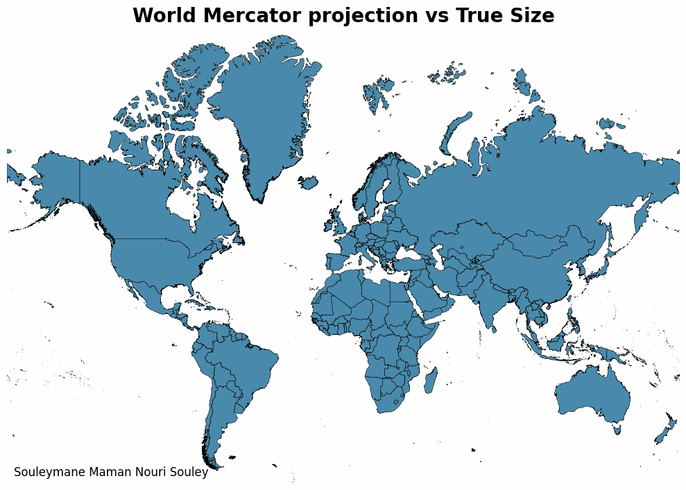
Visualizing the Real Scale of Nations with Python.